
Optimizing National Diagnostic Networks with GIS
Summary: Engaged at a national level to map all public laboratories using GIS and optimize a specimen referral network. Diag-Net’s analysis prioritized resource placement and designed an integrated data dashboard for health authorities, dramatically improving test turnaround and access in underserved regions.
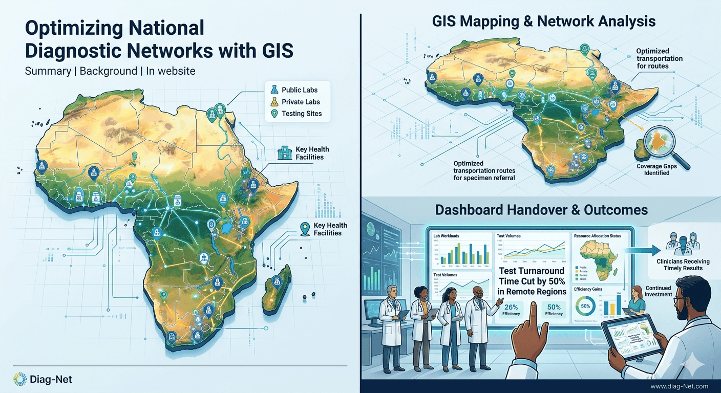
Background:
In a nation with vast distances and uneven lab coverage, Diag-Net partnered with health authorities to optimize the diagnostic network. We mapped all laboratories (public and private) and key health facilities with GIS to identify coverage gaps, in line with Africa CDC’s framework for geospatial lab mapping[2].
Approach:
- GIS Mapping: Collected geolocation and capacity data for every lab and testing site.
- Network Analysis: Designed specimen transport routes and referral networks that minimize transit time.
- Dashboard Handover: Built an interactive dashboard for the Ministry to track lab workloads and test volumes in real time.
- Platform Standardization: Provided recommendations on standard test platforms to reduce maintenance costs and stockouts.
Outcomes:
The redesigned network cut test turnaround by half in remote regions, ensuring timely results for clinicians. The GIS dashboard enabled health officials to allocate resources where needed most. By demonstrating improved efficiency, Diag-Net’s network design attracted continued investment and integration into the national health information system.